The Road Less Traveled
This is already almost two weeks overdue, but better late than never. In the actual order of my travels, it comes a couple of days before Thanksgiving. Right in the middle of this particular story is the motorcyclist who said, “I admire your lack of judgment.”
I like to think my lack of judgment started with good judgment: I don’t really do the Facebook. Ten years ago my publisher told me I need a social media presence, so I made an account. I imagine I must have posted 100 times by now. To me Facebook is like synchronized swimming: I’m happy for people who get something out of it, and for short periods I can pretend to be interested. That’s the best I can do.
Every once in a while this has negative consequences for me. In this case, I’m not on the Facebook TA page, so I didn’t get the memo: Highway 6 is closed. That’s the main artery connecting Picton (deep in Marlborough Sound, where the ferry from Wellington lands) to Nelson (the next major city on the TA). Damaged from torrential rains and flooding earlier in the year, it’s closed to all but local traffic at first, then to all traffic. As the ferry was pulling in to Picton, the other TAers on board asked me, “How are you going to get to Nelson?”
“I’m gonna bike there.”
“The roads are all closed.”
“Oh,” said the Worst Bikepacker in New Zealand.
They share their plans with me, clearly hoping I’ll pick one. The Sounds To Sounds Track sounds soundest. It connects Marlborough Sound in the northeast with Milford Sound in the southwest. A beautiful ride, if only I knew how to find the route. But I don’t own that guidebook, and despite the efforts of kindly strangers, we cannot get it loaded onto my phone. So that’s a resounding no to knowing Sounds To Sounds.
If we can’t load that route, obviously we won’t be able to load anyone else’s, because why would we be able to do that? I only have one biking-specific nav compooter, three biking-specific navigation apps, and the combined expertise of two other riders who report no trouble with their route-finding. Clearly insufficient resources to get this done.
I do have one resource in reserve, though, one these other riders don’t have: my man Gordon. I met Gordon a few weeks earlier in Taumarunui, in a motel close enough to the tracks that trains rattle the walls Elwood Blues-style. Until a nasty injury knocked Gordon off the track and into the hospital, he had been riding the Renegade Muster, an 840-kilometer deathball that makes the TA look like a kiddie rollercoaster. Seriously. Every Renegade I met thinks the TA is cute. But Gordon rode the first-ever TA in 2016, he has a near-photographic memory when it comes to biking, and he lives one kilometer off the TA in Nelson. He knows this ride. We stop to chat and he gives me the most important piece of intel I’ll need in Picton: ignore all the road closures.
If you obey the closures, he tells me, you’ll add a three-day detour on the one highway that is open, which is now the catch basin for all the traffic in the North End. Three days of heavy traffic, or one roll of the dice. I’ve never met Gordon before, but he seems pretty badass. Then again, I’m easily impressed. Worst Bikepacker and all that.
So I roll the dice. (Choose luck, remember?) I follow the Queen Charlotte Scenic Trail along the coast as far as it will take me. Then it’s onto Highway 6. At the first road closure, I keep riding. At the second, a construction worker stops me. “You’re not riding to Nelson, are you,” she asks. Her tone is exactly the same a kindergarten teacher uses when asking, “We don’t play with matches, do we.” I say I’m riding to Pelorus Bridge, which is absolutely true. It just so happens to be the next town before Nelson, but let no one say Steve Bein, ethics professor, is a liar. (You can also omit calling me a liar by omission.)
It turns out these road closures are no joke. On the mauka (inland) side of the road they’re rockfalls and landslides big enough to fill the lane. On the makai (seaward) side they’re, what, roadslides? In some places the entire lane has fallen off the cliff. They reduce car traffic to a long, single-lane, 20 mph speed zone, but guess what? That makes them biking heaven. No one to pass me for miles at a time. No one to pass me at high speed ever.
The Pelorus River is gorgeous, by the way. Crystal clear water, no sign of civilization except the bridge. If you jump in for a swim, you turn into 8mm black-and-white film footage. No reason for her to believe I was lying to her, which I totally was not.
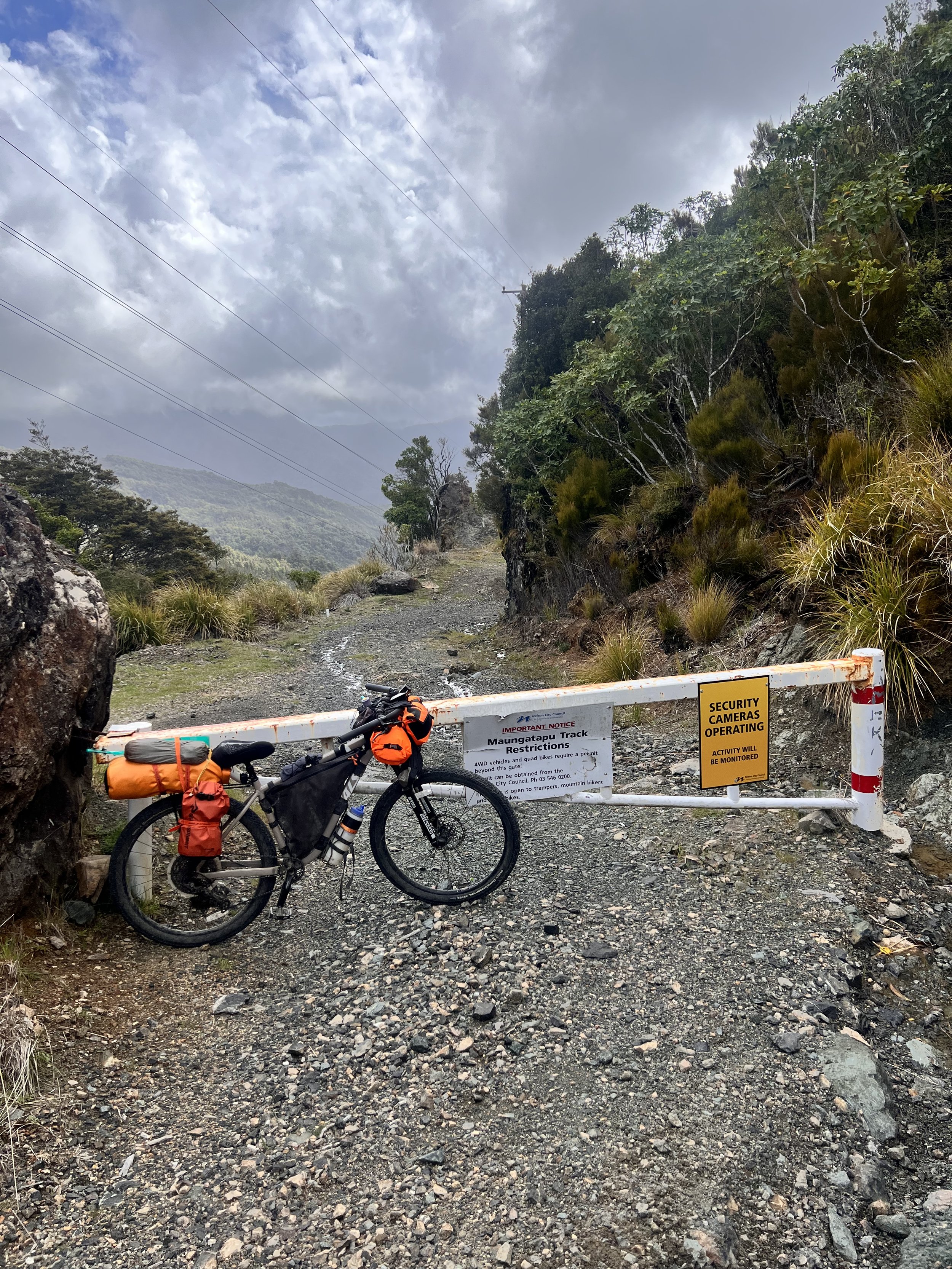
From Pelorus Bridge I left Highway 6—see? not lying!—for the Maungatapu Saddle trail. According to Gordon’s intel, this too is not closed, all DOT reports to the contrary. And he’s right! Laughing at the odds worked. The DOT’s website is wrong, therefore Facebook is wrong. But if you leave the interwebs and actually ride to the trail, you see the signs barring everyone except trampers, motorcycles, and mountain bikes.
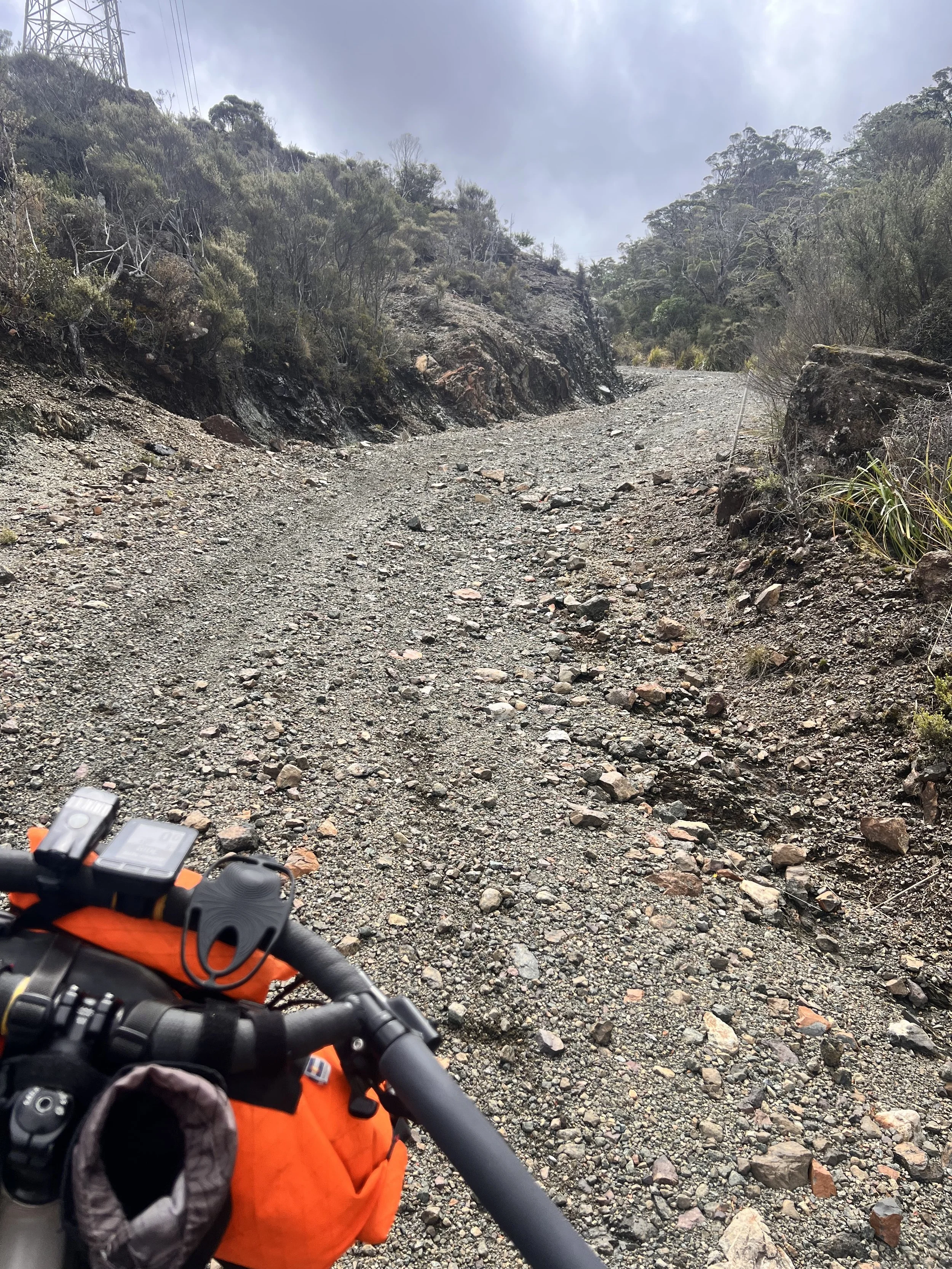
It’s open, but it ain’t easy. My guidebook says the Maungatapu Saddle is 12.5 kilometers ahead and the last two are unrideable. You’ll have to get off and push. Which is true, but Yours Truly pushed the seven or eight kilometers before that too. Booster always seems to enjoy these stretches, like a dog sticking her face out the car window, but I was sweating up a storm.
The last two kilometers really were the equal of anything I saw on Tassie. The TT was harder only because I’d face ten Ks of that calamitous climbing, sometimes more. The Kaiwhakauka was harder because of the terrain, but even that didn’t have the rain ruts I saw on Maungatapu. This one isn’t the deepest one I saw, just the deepest I was willing to drag Booster back out of. The biggest ruts were eight feet deep and five feet wide.
Toward the summit I met two guys on muddy motorcycles. We got to talking, as cyclists do. One of them is riding a Suzuki V-Strom, which is what I ride back home (though I think I would’ve had a hell of a time getting up this mountain even on that). We compare notes: what we’ve got in our packs (mostly the same stuff), how far we’ve ridden (38 kilometers for me, 380 for them), that kind of thing. I’m the first bicyclist they’ve seen in these hills, and the fellow Stromtrooper says, “I admire your lack of judgment.”
So there you have it. Hardest climbing award on the South Island goes to my first climb. Best conversation on the North Island goes retroactively to Gordon Sloane, Renegade, genuine badass, and really nice guy. On the far side of the Maungatapu Saddle, he rode up to meet me and escorted me home, where his wife Sharon (also a hardcore biker) made us a delightful vegetarian dinner and they put me up for the night.
Oh, and I did get on Facebook after all. Gordon took me through Nelson on a little tour of the town. I was exhausted but it’s a cool city, named for Lord Nelson, with all kinds of street names and buildings referring to naval history. (Halifax, Trafalgar, etc. No Nemo or Namor, though. I checked.) I’ve been re-reading my beloved Aubrey-Maturin novels on this ride, so a historical tour of Nelson was apropos even if I was too tired to stand.
As we rode through the central mall, a couple of guys— obviously bicyclists— waved us over. They asked if Gordon was riding the TA. Hmpf! My bike had all the bags on it. But he’s the one who looks like a badass. So Gordon says, “No, but this guy is, and they ask me how I got to Nelson.
“I just rode here.”
“On Highway 6?”
“And the Maungatapu, yeah.”
“No troubles?”
“No,” said the Lucky Bastard/Worst Bikepacker.
And so I ended up on Facebook after all. One of the first to cross, true to the true route, opening the floodgates to all those FBing TAers behind me. Thank you, Gordon! And thanks to Facebook for giving me too little interest to buy what it was selling.


